The revision of the Shoreline Management Plan in 2006 was motivated by an attempt by Duke Power to renew the hydropower project license on the Catawba-Wateree watershed. Duke Power has 13 hydropower stations on the Catawba-Wataree, which generate 841 megawatts annually.
As Duke presented their case for renewing the license, one of five priorities laid out was to maintain a comprehensive, responsive and cost-effective lake management program. To this end, Duke developed and made public a large amount of geospatial data on the Catawba-Wateree. These maps represent the geographic classifications of shoreline, with satellite and road basemaps to provide context. The classifications here are identical to those in the shoreline management guidelines.
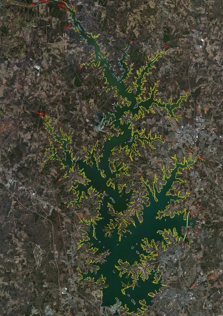
Satellite Basemap with Shoreline Classifications

Shoreline Classification Legend

Roads and Towns Basemap
In a cooperative digital online mapping project, Duke Energy and FERC have also created a dynamic map, which can be explored locally in much greater detail. This comprehensive and accessible resource is an important step towards providing public information on how the lake is managed, and where they are being considered. We encourage all interested individuals to take a look at this map – at first glance, the area around the lake appears to be mostly residential, but the ability to zoom in on the dynamic map shows that classification areas are often small and highly varied, with many different types existing in close proximity. This dynamic map allows a level of detail that the larger maps simply can not.
Sources:
Catawba Riverkeeper Foundation
2014 Lake Norman Page. Electronic document, http://www.catawbariverkeeper.org/our-work/covekeepers/lake-norman-page, accessed April 1, 2014.
Duke Energy
2014 Lake Norman. Electronic document, https://www.duke-energy.com/lakes/facts-and-maps/lake-norman.asp, accessed March 5, 2014.
Duke Energy
2014 Overview. Electronic document, https://www.duke-energy.com/catawba-wateree-relicensing/process-overview.asp, accessed March 1, 2014.
Duke Energy
About the Catawba-Wateree. Electronic document, https://www.duke-energy.com/catawba-wateree-relicensing/about-cw.asp, accessed March 1, 2014.
Duke Energy
Project Overview. Electronic document, https://www.duke-energy.com/catawba-wateree-relicensing/relicensing-interests.asp
https://www.duke-energy.com/catawba-wateree-relicensing/project-overview.asp, accessed March 1, 2014.
Duke Energy and FERC
2014 Duke Energy Catawba-Wateree FERC SMP. Electronic document, http://www.theoremgeo.com/smp/index2.html, accessed April 4, 2014.