Flood of 1916: Railroads

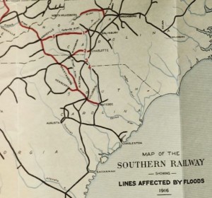
Map of the Southern Railway Showing Lines Affected by Flood of 1916. From: The floods of July 1916: How the Southern Railway Organization Met an Emergency.

Map of the Southern Railway Showing Lines Affected by Flood of 1916.
 
From: The floods of July 1916: How the Southern Railway Organization Met an Emergency.

According to thorough accounts released by the Southern Railway Company in 1917, the flood of 1916 posed high-level threats for the sociopolitical and economic landscape of the Carolinas. In their account of the events following the flood, the Company emphasizes their role in alleviating the situation, stating that they were inextricably responsible for this level of activism because they experienced the greatest financial loss of any company or individual. The costs to damages resulting from the flood are estimated at $1,250,000.

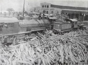
Debris left behind at a railroad station after flood waters receded.

Debris left behind at a railroad station after flood waters recede

The two most impacted lines in the Catawba river basin were at the Catawba River Bridge junction near Belmont and that near Eufola. The Belmont line accessed Charlotte and the Eufola line accessed Statesville, meaning the destruction of the bridges at these lines (which entered each city respectively) caused communication, trade and human transportation to be temporarily shut down. This had a large impact on the operations of both cities for up to several months.

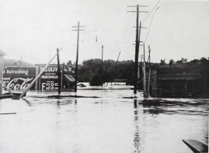
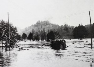
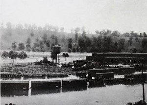
Floodwaters covering the tracks of a portion of the Southern Rail Line.

Floodwaters covering the tracks of a portion of the Southern Rail Line.

The Southern Railway Company also emphasizes the great loss of both lives and property as a product of the flood. Between tangible property, crops, livestock, farm property, suspension of business, railroads, bridges, trestles and culverts, the company estimated $21,724,085 lost due to the flood. In terms of human life, at the Belmont bridge outside of Charlotte, ninety people went down with the bridge and were lost.

The report issued by the Southern Railway Company in 1917 reveals a great sense of urgency and fear within the region surrounding the possibility of life-incidents in the future. The rhetoric used to explain the events proceeding the flood reveals a great deal of pride in the Company’s ability to respond and act as heroic agents of society. The writing implies a strong desire to improve flood controls and prevent such negative impacts by researching methods such as successful damming.
Flood of 1916

Gale Hits Carolina Coast

Flood of 1916 Background

On July 14, 1916, two tropical storms converged to hit the North Carolina/South Carolina coast simultaneously.  This strong storm hit Charlotte in the late afternoon on the 14th and lasted for 28 hours.  Rainfall totaled 5.15 inches, and set a record for highest recorded rainfall in a 24 hour period.  Winds overnight were reported to be at around 50 miles per hour and were particularly damaging to the city of Charlotte and the surrounding areas.  The storm intensified as it traveled northwest, with the heaviest rains occurring in the headwaters of the Catawba.  The Catawba raged for the two days following and the high waters caused intense damages to the area.

Click on the links to learn about some of the areas that were impacted:

Railroads

Bridges 

Charlotte, NC 

Crop Damage


flood in townConstruction of Dams and Flood Control on the Catawba

The construction of dams along the Catawba has a long history that starts back before the flood of 1916.  Dams were constructed along the Catawba in attempts to both control floods and as a source of hydroelectric power.  Following the flood of 1916, momentum behind damming as a method of flood control was intensified in order to try and prevent a similar catastrophe from impacting the lands surrounding the Catawba.

Lookout Shoals Dam

Indian Hook/Lake Wylie Dam


Sources and Further Reading:

Bell, W. M. (1916). The North Carolina flood: July 14 15 16 1916. Charlotte: W. M. Bell.

Jacobs, C. (2008). Around Lake Norman. Arcadia Publishing.

Scoggins, M. C. (2009). Historic York County: An illustrated guide. HPN Books.

Southern Railway (U.S.). 1917. The floods of July 1916: how the Southern Railway organization met an emergency. Washington: Southern Railway Co.


Images:

All black and white photographs: Southern Railway (U.S.). 1917. The floods of July 1916: how the Southern Railway organization met an emergency. Washington: Southern Railway Co.

Newspaper Headlines: Various articles. (1916, July 13-17). The Charlotte Observer.


The Flood of 1916: Bridges

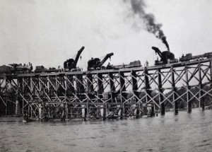
Building a temporary replacement structure near Fort Mill, SC. From: Southern Railway, 1917.

Building a temporary replacement structure near Fort Mill, SC. From: Southern Railway, 1917.


More than several dozen bridges were taken out by the rushing waters of the flood of 1916. These bridges, suspended over the Catawba River, were washed away by the rising waters and resulted in several of the deaths and several of the hundreds of thousand dollars in damage that the flood resulted in. The Belmont Bridge trapped 18. The Seaboard Air Line steel bridge at Mount Holly, the Interurban steel bridge, and the county highway steel bridge were all brand new and were estimated to have been worth over $125,000 at that time. Perhaps one of the most memorable bridge collapses though was the Southern Railway’s bridge that was only 11 miles from Charlotte and largely affected the transportation and communication in and out of the city after the flood.

The Flood of 1916: Storm Damage in Charlotte

Headline from the Charlotte Observer

Headline from the Charlotte Observer

The record breaking wind and rainfall that caused the flood of 1916 were perhaps the most devastating elements that affected the city of Charlotte. Luckily, the Catawba River did not run close enough to the city for the flood waters to have directly affected it. However, the flood did demoralize the railways, and the telegraphs and telephone communication, thus cutting Charlotte off from a wide area South and West as the Catawba continued to take down bridges and wires. No trains could travel in or out of the city for an extended period of time and city dwellers lost all power.  First estimates of the crop damage exceeded $10,000,000, and property damage was later estimated to be over $15,000,000.  Although the city was void of direct contact with flood waters, it was largely affected by the damage of the storm in the city and the greater area.

The Flood of 1916: Crop Damage

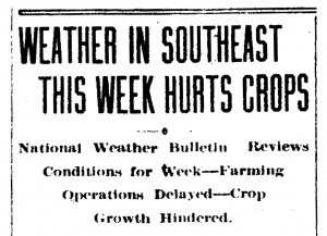
Headline from the Charlotte Observer.

Headline from the Charlotte Observer.

In addition to the damages to infrastructure such as dams, railroads, and bridges, the Great Flood of 1916 also caused crop damage estimated at an excess of $10,000,000  in the North Carolina Piedmont and across the greater southeast.  Agriculture was a main source of livelihood within the Piedmont region at the time and corn, tobacco, and cotton crops were all hit hard by the storm.  Crops were impacted by the sustained heavy winds and fields were flooded with the heavy rains or washed out by the high waters of the Catawba.  Many of these washed out fields were unable to recover as the fertile topsoil had been washed away and sand deposited on banks.

Additionally, a number of cotton mills on the banks of the Catawba were damaged.  A large amount of cotton stored in these mills were washed down river and lost, equaling lost profits not only from damaged crops in the field but also those in other stages of production.

The Flood of 1916: Lookout Shoals Dam

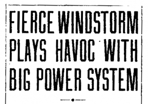
Power lines damaged in the flood.

Power lines damaged in the flood.

The Lookout Shoals Dam was built by the Southern Power Company in 1915.  This dam supplied energy to the greater Mooresville area and was the furthest north on the Catawba River at the time.  During the Flood of 1916, both the dam and the powerhouse were covered by the high water.  Although the structure of the dam itself did not suffer significant damage during the storm, other damage to the powerhouse, equipment and power lines cut off power to Mooresville until repairs could be made.

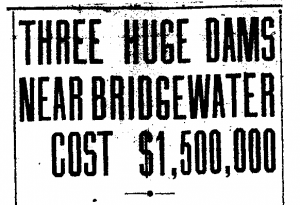
In the days immediately following the Great Flood, plans to construct a system of three new dams near Bridgewater, NC were being solidified.  Although plans to construct these dams had already been underway, the destruction of this flood reinforced the necessity of further damming the Catawba.

The Flood of 1916: India Hook/Lake Wylie Dam

In 1899, Dr. Walker Gill Wylie founded what would later become the Southern Power Company and funded the construction of the India Hook Dam. Construction on the dam began in 1900, however a 1901 flood effectively destroyed the unfinished dam and construction had to be postponed. With additional funding from one of Dr. Wylie’s patients, James Buchanan Duke, construction on the dam was restarted. Construction finished in April of 1904, and the India Hook Dam became the first major hydroelectric dam constructed on the Catawba River. It provided hydroelectric power to many counties along the North Carolina/South Carolina Border, including the greater Charlotte area. Building the dam also created a large man-made reservoir behind the dam (which would later be named Lake Wylie after the Southern Power Company president).

Headline from the Charlotte Observer.  In the days following the flood, plans were finalized to construct three new hydroelectric dams further north on the Catawba in order to generate power and try and prevent a flood of this magnitude from occurring again.

Headline from the Charlotte Observer. In the days following the flood, plans were finalized to construct three new hydroelectric dams further north on the Catawba in order to generate power and try and prevent a flood of this magnitude from occurring again.

During the high waters and winds in the storm of 1916 the India Hook Dam developed a large crack. By the end of the storm the entire eastern portion of the dam had been washed away leaving both the dam and the lake effectively destroyed. Additionally, the downstream powerhouse was damaged by the floodwaters. The dam and powerhouse were repaired following the flood. However, this failure demonstrated the need for design improvements to prevent further incidents. In 1924, renovations led to the construction of a dam four times taller and with a higher power output than the original dam. This new India Hook dam remained a major source of power to the area until the completion of Duke Energy’s Catawba Nuclear Station in the 1980’s.